History of The Texas Connection With Ballygarrett
In 1833, some 600 people led by the Empressario James Power left Ireland to found a new Irish settlement under Mexican jurisdiction in the state of Texas. Some few years earlier Mexico had won independence from Spanish rule and a new colonisation statue had been enacted desiring by every lawful means to augment the population of their sparsely populated territories and permitting individual states within the Mexican Federation to formulate their own immigration laws.
The laws adopted by state of Texas were particularly favourable to immigration from Ireland. The Refugio and San Patricio areas of south Texas were selected to be colonised by the Irish Four Irish Empressario’s became involved James Power & James Heweston in Refugio with John McMullen and James McGloin in San Patricio. The Empressario’s (i.e. Land Agents) made contracts to colonise the land with people who were “Irish, Catholic and of good moral Character”. The land available amounted to about 1,000 acres per family after the Empressario’s had their share. This was a vast fortune in the eyes of the colonists.
James Power was born, probably at Cahore, Ballygarrett, Co. Wexford in 1778. He emigrated to North America in1809 and engaged in the business of trading, first in Philadelphia and later in New Orleans, on the Gulf of Mexico. Many people with Irish connections had moved westwards after the tragedy in 1798, with the hope of carving out a better and freer life in the newly emancipated state of North America. Power, became aware of the possibilities that existed for the people of his native Wexford in the development of Texas. They were an industrious farming breed and had suffered much privation in the aftermath of the 1798 Uprising Such loyalists as Hawthery White, Hunter Gowan and other greedy land seekers were relentlessly chasing the tenant farmers off their lands.
Power met up with James Hewetson a Kilkenny man who had medical practice first in Missouri and later after travelling south with Stephan Austin in Saltillo. When the Texas land became available for colonisation they had common cause in seeking accommodation for their hapless neighbours and kindred back home. Hewetson had by this time married into a powerful Mexican family and thus had some influence in decision – making places. Power was later to make a somewhat similar marriage.
The Sparsely populated territory in the Refugio And San Patricio area granted to the Power and Hewetson colony was the homeland of the Karankawa Indian tribe who were much feared for their ferocity in defence of their territory and who were widely believed to be cannibal.
Power and Hewetson contracted with the Mexican government to bring over settlers from amongst the oppressed Irish smallholders to colonise the area. Power came home to Ballygarrett in 1832 and after much travel and organising induced some 600 people to emigrate. Two parties set sail from Liverpool for New Orleans in December1832 and January 1833, some of the migrants perished en route during the slow and torturous sail voyages of the time. The survivors landed at New Orleans where a number of them contracted the dreaded Cholera. After lingering for a time, they found lonely graves in far off Louisiana on the banks of the Mississippi River. The survivors transferred to smaller craft and made their way to Copano Bay with their crude implements and other belongings. Even then their woes were not over. One of their boats capsized in Copano Bay with the loss of much of their goods and chattels. Worse still was to come for of the Texas Revolution.
The Mexican democratic government had by this time been usurped and the new military dictator, General Antonio Lopez de Santa Anna, had declared the land contracts signed by his predecessors to be null and void.
Supported by a Mexican army, de Santa Anna speedily arrived on Texan soil to enforce his decree. The would – be settlers now faced civil war in addition to their other woes. The fight was long, bloody and vicious. In addition to the well remembered battle of The Alamo in San Antonia in 1836 there were many other fierce and bloody battles between the Mexican army and the settlers. Others who had come to the area in search of land and fortune backed up the latter. Much of the land had been laid waste during the battles. In the true spirit of pioneers they set about the formidable task of breaking the virgin lands and setting up colonies in Refugio, Victoria and in Gooliad, where another noted battle in the conflict had been fought. James Power became a leading figure in establishing Texas as a State and bringing it under American influence. He represented the area in Congress and helped to set out the land for distribution and registration. He became a towering figure in his adopted land and brought many of compatriots to positions of influence and power with him. Many of these families nurtured their land grants carefully and increased the size of their holdings, buildings in the case of his nephew, Tom O’ Connor, a ranch of near one million acres.
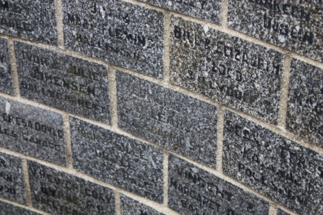
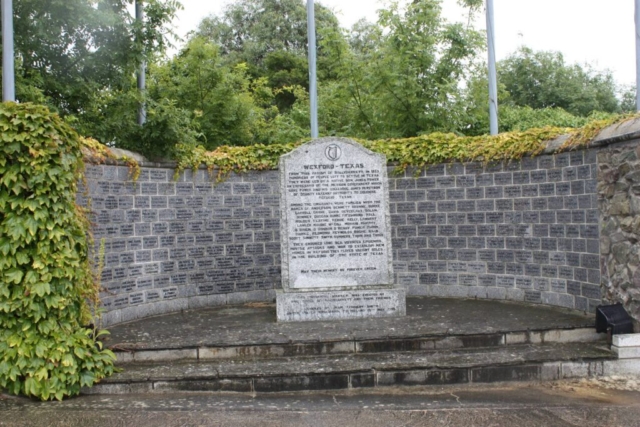
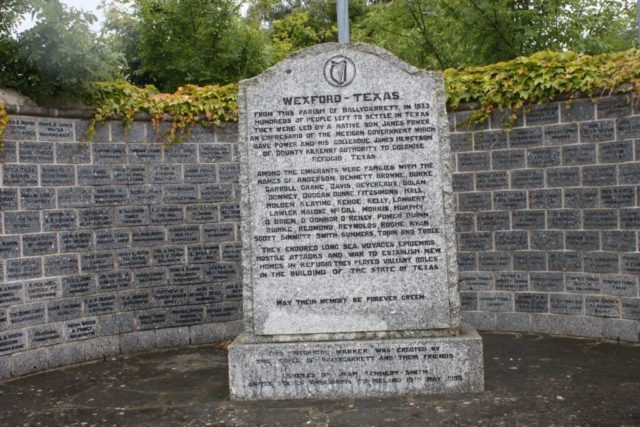
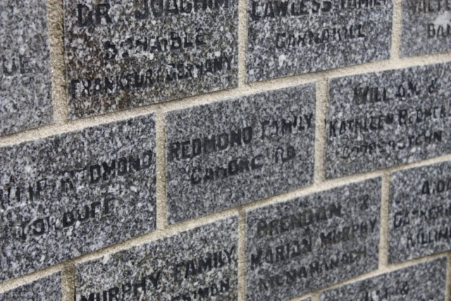
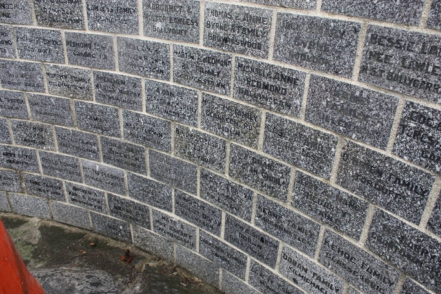
The names of many of the early settlers are engraved on the memorials in Ballygarrett and Refugio as a lasting memorial to their enterprise and courage in leaving all behind and following James Power to death or freedom. These impressive memorials, bearing the names of many of the pioneers, were designed, planned and erected at both locations mainly by public subscription.
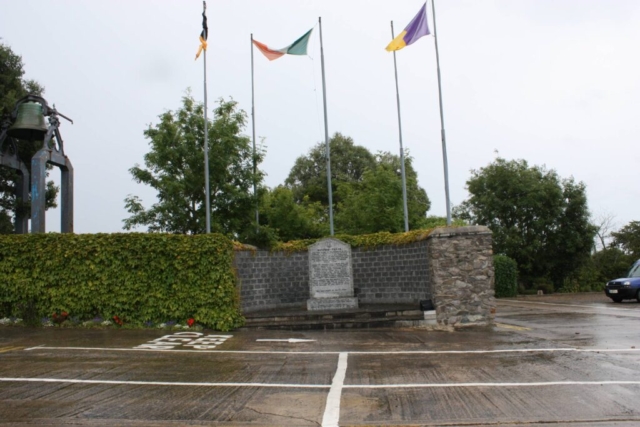
The memorial at Ballygarrett was unveiled on 19th May 1996, by Mrs Jean Kennedy Smith, United States Ambassador to Ireland and in the presence of some 140 Texas Irish who had travelled to Ballygarrett for the occasion: most of them were descendants of the original emigrants.
Through the good offices of Wexford County Council, and the Town Council in Refugio Ballygarrett and Refugio officially twinned for cultural economic and tourism purposes. The Wexford County Manager, Mr Seamus Dooley and the then T.C. M.C.C. joined the party in Refugio for the official twinning ceremonies, High Ranking dignitaries both Federal and State attended on the U.S. side
From the settler families of 1833 -4 many links are still around O’ Connor’s, Fagan’s, Lambert’s, Power’s, McGuill’s, O’ Reilly’s, Duggan’s, Fitzsimon’s, Kelly’s, Roche’s, O’Brien’s Smith’s, Hall’s, Keating’s, Murphy’s, Malone’s, Tobin’s and their descendants through many generations may still be found both in Texas and in Ireland.
The Power colony is one of the colonial enterprises named in every Texas history and James Power a role model for the colonisation of new lands everywhere. Many writers have penned the History of these people and their daunting undertaking Monsignor Wm. Oberste in his The Texan Irish, Richard Roche in his Texas Connection and Lucy Fagan Snider and her fellow historians in Refugio under the title Refugio Country History are but a few.
Today, this impressive memorial in Ballygarrett stands tribute to the pioneering spirit of our forefathers who faced the perils of settling in a strange land amongst a hostile people while wringing a living from a reluctant, virgin soil.
The flags of Ireland, the United States, Mexico Goliad and Wexford fly high in Ballygarrett in honour of their courage and valour in that troubled time in our history.
Coupled with the nearby memorial to those millions, who suffered and died in The Great Famine of 1847, Ballygarrett’s need to remember and honour its past is adequately fulfilled.
We ask that you all feel welcome to share with us in our commemoration of the tragedies and triumphs of our people.
BALLYGARRETT HERITAGE COMMITTEE
MAY 2000
The present parish within the jurisdiction of Ballygarrett in the RC sections covers part of the area once under jurisdiction of the priory of Glasscarrig and the ancient parishes of Donaghmore, Glasscarrig, Killenagh and to some extent, Kiltrisk. The present edifice of the Reformed Church at Clonevan is referred to on Ordnance Survey Maps as Donamore. It was built to replace the ruined church in Donaghmore cemetery and a different spelling was used by the cartographers perhaps to distinguish one from the other.
The Old Killenagh church and cemetery site is in the townland of Tomduff No trace of the walls remain but the outline of its structure can be made out. It was described in 1615 as “being down” but was evidently repaired and continued to serve as the Parish Church until 1828 until a replacement Parish Church was built at Ballyduff Cross. Local tradition tells us that the stones from the old Church building were carted and used to build its successor less than one mile distant as the crow flies. The new Church was called Killena Church again; perhaps, to distinguish it from the one it replaced. Neither did the new edifice survive the ravages of time nothing but the site now remains.
Sir Walsingham Cooke lived at Tomduff House, adjacent to the Old Killenagh Church. A long lane, commencing at “the Goose Green” and ending at the Tomduff Stream approaches the farm. The church and burial ground were located on his hands to the right of the laneway leading to Tomduff House.
In 1619, Cooke received some 500 acres of demesne land in Cookstown and surrounding area. The Gaelic name for this place was “An Culog Buide” (the Yellow Hill-back) and it may have been know by some derivation of this prior to Walshgham Cooke acquiring it and implanting the Cooke name to perpetuate his memory.
The two memorials found in the graveyard are recorded in their work. The Cooke slab seems to have been the cover stone of a vault, a suggestion strengthened by the presence of a depression in the ground that may be the collapsed vault.
In a field on the opposite side of the lane to Tomduff House and close to the entrance to the graveyard is a stout flagstone some 6 feet in height and 2 feet in diameter. It seems to be the remnants of a crude cross from ancient times. If this proves to be the case, it should have a more secure site or else protected in situation in the adjacent graveyard.
Kiltrisk is another old ecclesiastic site in the same area. It is in the townland of Glebe, south of Clonganny House, (a Hawtry White property) and due west of Peppards Castle, built by one Patrick Peppard circa 1550 (Mrs Hinkson). Lewis writing in 1837 says, “the walls of the ancient Castle have been incorporated in the house still called Peppard’s Castle. It would appear that the castle was built on church lands belonging to the Glascarrig priory. There may have been an earlier structure in this site as Jeffrey in his “Castle of County Wexford” (edited by Ed Cullenton) mentions that Richard Peppard, a tough Norman Knight, built his 13th century Co. Wexford castle on church land in defiance of the bishop”. The Peppads may well have had Wexford associations before the coming of Walter Peppard, mentioned above. In the 1500’s they owned and operated the mines at Barrystown, near Wellington Bridge. The Peppard’s Castle lands amounting to some 770 acres are adjacent to the Pounden lands of Ballywater of some 940 acres. George Taylor, who wrote in 1800, “The Rebellion in Wexford – a historical account of the rise, progress and suppression of the Rebellion in the County of Wexford in the year 1798”. Taylor himself was caught up in the rebellion and narrowly escaped death on Wexford Bridge during a massacre there on 20 June 1798.
Near a bend in the road at Ballyduff, close to Primrose Cottage, is a bridge at which a battle was during the Cromwellian war here. It will be remembered that some of Cromwell’s forces were wounded or well ill as the main body marched on Wexford. These remained in Dublin and when they were stronger, were marched down to help in the occupation of Co. Wexford. They were in battle with the Royalist forces on the strand of Donoughmore and Glascarrig. Some of them retreated and were overtaken and engaged at Ballyduff. Their grave mounds were to be seen in the field to the north of the bridge and were obliterated only in recent land reclamation works. One of the capstones on the bridge itself is granite and carved with the number 46. The stone clearly had another use before being placed in its present position.
Local lore says that there was a church or other religious structure in the Townland of Templederry near where the drainage canal now runs. This may have been a “booth” or “hut” from the Priory at Glasscarrig. The name “Temple Derry” probably “the Church (or Temple) in the (Oak) Wood” suggests that a church or temple did exist there. No trace of it appears on the Sites and Monuments survey maps. There is evidence of an enclosure at Ballinoulart some short distance south of Templederry; this may be the one referred to in local lore. Could it be that Templederry stretched further south in earlier times, though one would have thought that townland boundaries were well fixed.
Re Hawtrey White:
In jottings of the past there was a note on “Hawtrey White, the alarmist” saying that before the rising, White was responsible for the report that a general rising of papists was intended and a wholesale massacre of Protestants in Wexford was contemplated. General Hunter ordered that White be summoned before him and when he arrived he was asked to state his authority for what he had reported. He replied that to his own knowledge the rebels had formed an encampment on an island two miles from the land from whither they went every morning after harassing the country during the night. He made a request that he personally should be entrusted with a force to prevent the rebels from landing on the mainland again. Hunter pretended to believe the story and sent White in a gunboat to proceed to the island he had mentioned. At the same time he positioned a party of soldiers on the seashore. No such island of course existed and White was brought before court martial but his age and the intercession of the gentry of the country on his behalf prevailed on General Hunter to refrain on punishing him. White resided in Peppard’s Castle and died in 1817.
